|
617 NW 20th Avenue Gainesville, Florida 32609 Tel: 352.367.1700 |

|
|
|
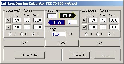
The Lat/Lon tool will compute the range and bearing between to points you specify. Or, if you specify one point and a range and bearing, it will compute the other point.
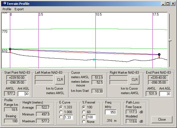
Once you have two points in the Lat/Lon tool, you can display the Terrain Profile tool. The Terrain Profile tool will show the profile between the two points. In addition to the terrain, it will show the line-of-sight (blue) and Fresnel zone (red) lines. Notice that you can modify some of the parameters such as antenna height and frequency. As you make changes, the path loss calculations will update to reflect the changes.
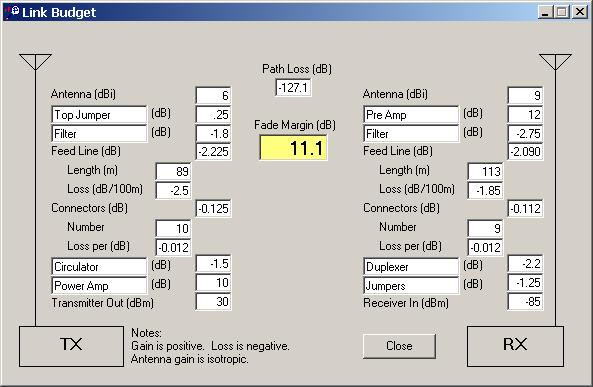
From the profile, you can bring up the Link Budget tool to analyze the entire link:
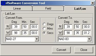
The conversion tool converts linear and field strength measurements and can convert between NAD-27 and NAD-83 coordinates.
| ||
|
|
rfSoftware | About | Features | Screenshots | Pricing | Downloads rfDetective-FM | rfInvestigator-FM | rfProfiler Light Copyright © 2004, rfSoftware, Inc. |